3D Ports
GIS,GPS, Field Asset and Inspection Management System
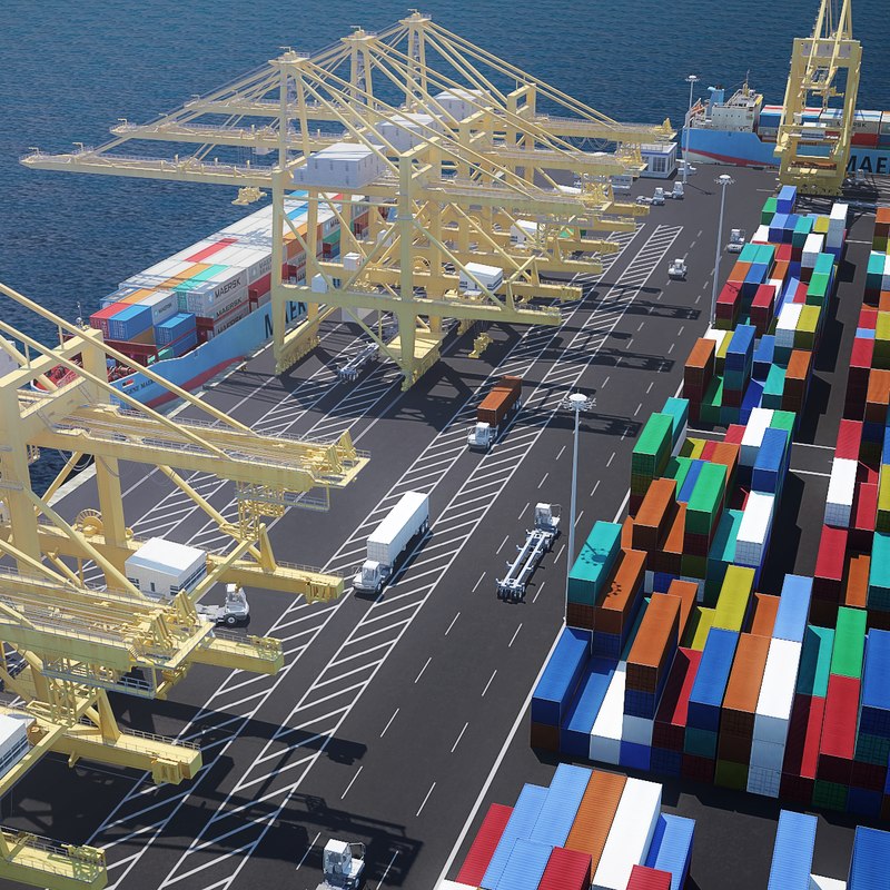
3D Ports
3D Web GIS solution for Ports is to monitor vehicles, equipments and sensors fitted with vehicles in real-time and to track jobs assigned to the vehicles, its operators and measure KPIs. This solution not only brings better visualization of vehicles in 3D, but also improves the operational efficiency of vehicles by calculating no. of containers, type of containers to be loaded/unloaded in sequence using Z values.3D Ports is a holistic solution for managing the entire PORTS Ecosystem on Operations and integrations with Asset Management System, Material Management, Environment, land Management and Security
Technologies
CesiumJS, NSG3DMap API, PostGIS, Microsoft .Net Web APIs, HTML5/CSS3/JS and ReactJS
Key Features
- Live tracking of Vehicles, Equipments and Sensors
- Short term Lease Management
- Scheduling Customer Inspections
- Location based Field Inspections
- Online Tracking
- GIS dash board & Reports
- Mobile Interface
- In-App Calling to Vehicle Operator
- Notifications & Alerts
- Live Video feeds